In six hours, 7.68 inches of rain fell in St. Louis — an event with less than a 1 in 1,000 chance of occurring in a given year, according to the National Weather Service. Some areas northwest of the city saw rainfall totals up to a foot.
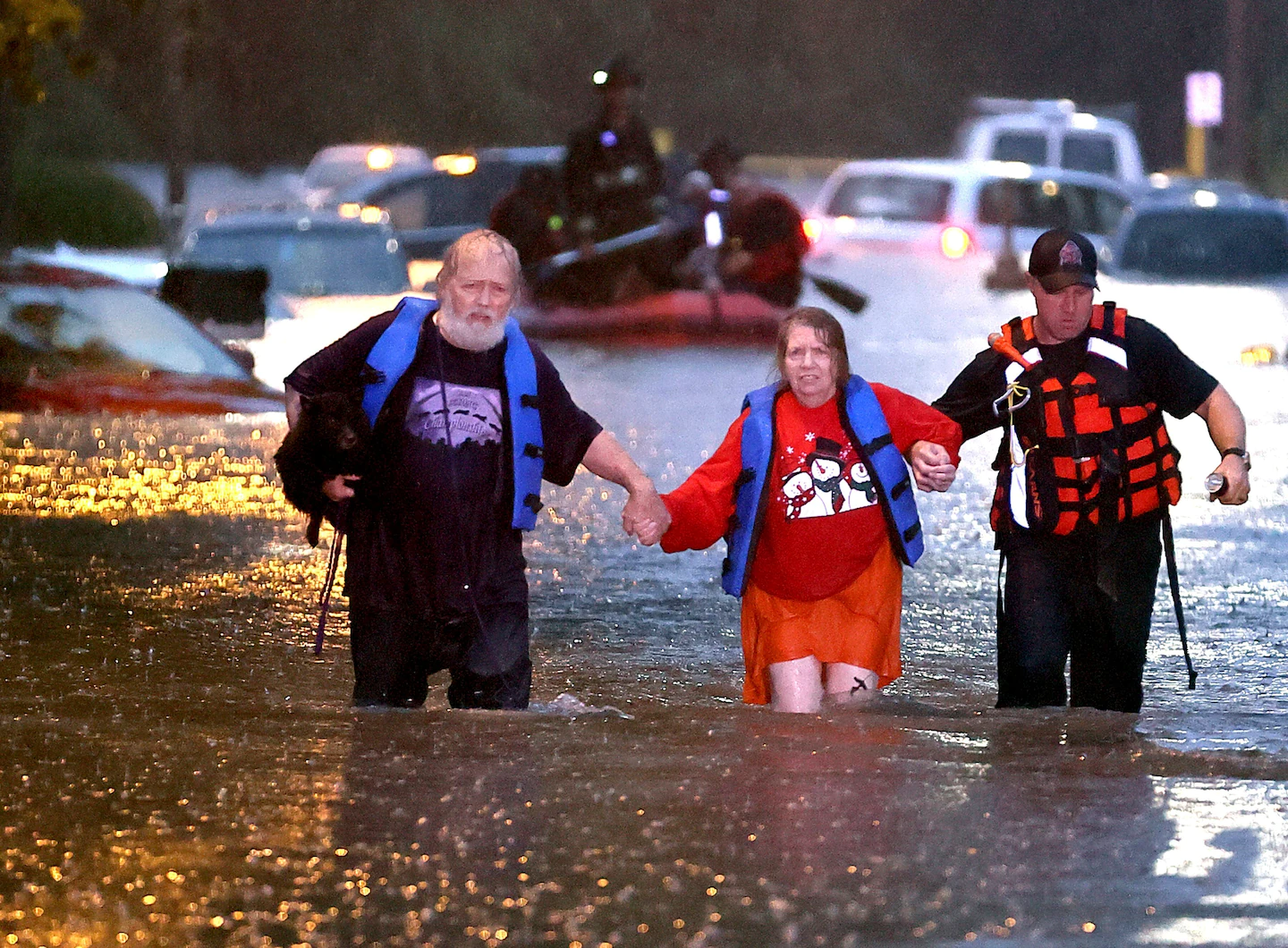
Firefighters had responded to about 70 rescues by late Tuesday morning, St. Louis Fire Chief Dennis Jenkerson told reporters. On one block in the western part of the city, the fire department said, it had used an inflatable boat to rescue six people and six dogs trapped in about 18 homes amid severe flooding. About 15 people chose to shelter in place.
Around 10 a.m., a person’s body was pulled out of a car that had been covered by about 8½ feet of floodwater, Jenkerson said. He said the incident was under investigation, and he did not provide additional details.
Although floodwaters were receding Tuesday afternoon, Jenkerson said the water’s weight had caused some roofs to partially collapse. He called the property damage “significant.”
Videos shared on social media showed many low-lying roads completely inaccessible. Part of Interstate 70 was closed Tuesday afternoon because of the flooding, the Missouri Department of Transportation said.
St. Louis County emergency officials urged residents not to travel and said they had set up a shelter for displaced people. The central part of the county was most affected by the downpour, they said.
“Exercise extreme caution,” St. Louis city firefighter Garon Patrick Mosby said in a video shared on Twitter. “We are being overrun here.”
On behalf of Gov. Mike Parson (R), who was out of the country Tuesday, Lt. Gov. Mike Kehoe (R) declared a state of emergency to assist local authorities in handling the disaster.
Parson tweeted that he had been briefed on the flooding, and both thanked those who helped their fellow Missourians.
Extreme precipitation events have increased substantially over the past century and are tied to warming from human-caused climate change. The heaviest such events increased by 42 percent in the Midwest between 1901 and 2016, with additional increases expected as the climate continues to warm, according to the U.S. government’s National Climate Assessment.
The rain in St. Louis began late Monday as thunderstorms formed along a west-to-east line, repeatedly passing over the city like train cars on a track into Tuesday morning. The Weather Service warned of “life threatening flash flooding” just after 2 a.m. and later declared a flash flood emergency, its most serious flood alert. By then, 3 to 6 inches of rain had fallen and high water was “threatening houses” and vehicles were submerged, according to the Weather Service.
“This is a particularly dangerous situation,” it warned. “Seek higher ground now!”
A creek in St. Peters, northwest of St. Louis, rose 21.5 feet in seven hours to a record crest amid the torrent.
The thunderstorms formed along the northern periphery of a heat dome sprawled over the south-central states, responsible in recent days for record-high temperatures in parts of Texas, Oklahoma and Arkansas. St. Louis was situated in the turbulent transition zone between that oppressive heat and cooler weather entering the Upper Midwest from Canada.
On Tuesday, the Weather Service declared the area from eastern Missouri to central West Virginia under an elevated risk for excessive rainfall, with the greatest risk from the St. Louis area through southern Illinois and into southwest Indiana. That risk is forecast to shift into the area from southeast Missouri through West Virginia on Wednesday and Thursday.
Three consecutive days with an elevated threat of flash flooding in central and southern Appalachia as a plume of deep moisture parks over the region. For the latest Excessive Rainfall Outlooks, including an interactive map, go here: https://t.co/4vi9EBZpIU pic.twitter.com/RDPO5wqBvO
— Alex Lamers (@AlexJLamers) July 26, 2022